In 1086, the area now known as Furness was recorded in the Domesday Book as part of the Manor of Hougun. At that time, there was no town of Barrow-in-Furness. Instead, the Furness peninsula consisted of scattered rural settlements, farmland, and small coastal communities, many of which can still be recognised today.
The Manor of Hougun: Furness in the Domesday Book
17 October 2025
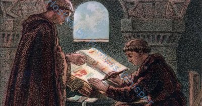
The Domesday Book was commissioned by William the Conqueror as a detailed survey of land, resources and population. Hougun — probably centred near Dalton — took its name from the Old Norse haugr, meaning “hill” or “mound”. The name reflects the area’s strong Viking influence, which remains visible in many local place names.
Domesday Book Settlements in Furness
The following places were recorded as part of the Manor of Hougun and fall within the historic Furness area:
Hietun (Hawcoat)
Rosse (Roose)
Hougenai (Walney Island)
Daltune (Dalton-in-Furness)
Ulvreston (Ulverston)
Beretseige (Bardsea)
Chiluestreuic (Killerwick – lost)
Sourebi (Sowerby)
Warte (possibly Thwaite Flat)
Neutun (Newton)
Walletun (lost)
Suntun (Sunbrick / Stank)
Fordebodele (near Roose)
Hert (Hart – lost)
Lies (Leece)
Alia Lies (a second Leece)
Glassertun (Gleaston)
Steintun (Stainton)
Clivertun (lost)
Ouregrave (Orgrave)
Meretun (Marton)
Pennigetun (Pennington)
Gerleuuorde (Ireleth)
Borch (Broughton-in-Furness)
Many of these places remain familiar today, while others have disappeared over time. Some are remembered only in field names, archaeological evidence or written records.
Life in Furness in 1086
In the late 11th century, Furness was a quiet but active rural landscape. Fields were cultivated with oxen, and most people lived in small hamlets surrounded by open farmland. The smell of woodsmoke from hearth fires would have drifted across the countryside, and the sound of livestock carried through the air.
Coastal areas such as Walney (Hougenai) and Bardsea (Beretseige) would have been shaped by the tides and winds of Morecambe Bay. Inland settlements like Roose and Hawcoat focused on farming, with pasture and arable fields forming the backbone of daily life. Dalton was already an important local centre, strategically placed inland but close to routes linking the wider region.
Hougun in Historical Context
The Manor of Hougun was one of the largest estates in the north-west recorded in the Domesday Book. Its size and number of settlements reflect its significance both economically and strategically.
The Norse influence in Furness remained strong at the time of the survey. Many of the settlement names are clearly derived from Old Norse or Old English, showing how Viking settlers and their descendants had shaped the landscape. By 1086, the area was under Norman control, but its local character was still defined by these earlier communities.
Lasting Legacy
The names recorded in the Domesday Book still shape the Furness landscape today. Modern settlements such as Dalton, Ulverston, Pennington, Roose, Hawcoat, Walney, Gleaston and Leece can trace their recorded history back to this period. Others, such as Killerwick, Walletun and Clivertun, have vanished, leaving behind only traces in the historical record.
Standing in these places today — with the sea air at Walney, the open fields of Roose, or the village streets of Dalton — it’s easy to imagine the same land being worked and walked on nearly a thousand years ago.
The Domesday Book offers more than just names on a page. It provides a rare glimpse into the structure and life of early Furness — a rural, Norse-influenced landscape on the threshold of medieval change.
100%